


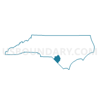
Voting District 07, Robeson County, North Carolina
About
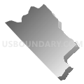
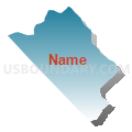
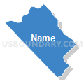
Outline

Summary
| Unique Area Identifier | 641253 |
| Name | Voting District 07 |
| County | Robeson County |
| State | North Carolina |
| Area (square miles) | 19.34 |
| Land Area (square miles) | 19.34 |
| Water Area (square miles) | 0.00 |
| % of Land Area | 100.00 |
| % of Water Area | 0.00 |
| Latitude of the Internal Point | 34.44207160 |
| Longtitude of the Internal Point | -79.21098340 |
Maps


Graphs
Select a template below for downloading or customizing gragh for Voting District 07, Robeson County, North Carolina


Neighbors
Neighoring Voting District (by Name) Neighboring Voting District on the Map
- Voting District 05, Robeson County, NC
- Voting District 06, Robeson County, NC
- Voting District 29, Robeson County, NC
- Voting District 38, Robeson County, NC
- Voting District 40, Robeson County, NC
- Gaddy's Mill Voting District, Dillon County, SC
- Hamer Voting District, Dillon County, SC
- Lake View Voting District, Dillon County, SC
- Pleasant Hill Voting District, Dillon County, SC
Top 10 Neighboring County Subdivision (by Population) Neighboring County Subdivision on the Map
- Hamer CCD, Dillon County, SC (6,017)
- Fairmont township, Robeson County, NC (5,518)
- Lake View CCD, Dillon County, SC (4,370)
- Rowland township, Robeson County, NC (2,351)
- Gaddys township, Robeson County, NC (1,511)
- Thompson township, Robeson County, NC (1,236)
- Whitehouse township, Robeson County, NC (1,053)
Top 10 Neighboring Unified School District (by Population) Neighboring Unified School District on the Map
- Robeson County Schools, NC (134,168)
- Dillon School District 2, SC (18,998)
- Dillon School District 1, SC (5,462)
Top 10 Neighboring State Legislative District Lower Chamber (by Population) Neighboring State Legislative District Lower Chamber on the Map
- State House District 47, NC (73,340)
- State House District 48, NC (66,444)
- State House District 55, SC (34,048)
Top 10 Neighboring State Legislative District Upper Chamber (by Population) Neighboring State Legislative District Upper Chamber on the Map
Top 10 Neighboring 111th Congressional District (by Population) Neighboring 111th Congressional District on the Map
Top 10 Neighboring Census Tract (by Population) Neighboring Census Tract on the Map
- Census Tract 9702, Dillon County, SC (6,017)
- Census Tract 9617, Robeson County, NC (5,568)
- Census Tract 9618.02, Robeson County, NC (5,198)
- Census Tract 9619, Robeson County, NC (4,995)
- Census Tract 9705, Dillon County, SC (4,370)